When Rome was proclaimed the capital of Italy, the Esquiline Hill – an area comprised between the city and its suburbs which underwent different phases and functions over history – has been affected by a feverish construction activity aimed at transforming it into a residential neighborhood. A series of interventions, completely inadequate from an archaeological point of view, along with incomplete excavation reports, has hindered the understanding of this multifunctional and stratified urban area. This project aims to understand its inhabitation dynamics and development between the 2nd century BC and Late Antiquity.
The consultation of the Archaeological Territorial Information System, the reordering of unpublished excavation records stored in the city’s main archives, and the systematic analysis of excavation journals, area reports and findings registers proved indispensable for reconstructing the history of the earthwork and excavation interventions undergone by the area
Sketches, excavation drawings and photographic documentation dating back to the 19th century have also been analysed, including the collection of shots by J.H. Parker preserved in the Photographic Archive of the British School at Rome.
The study of archaeological, epigraphic and topographic emergencies of the eastern side of the hill (known in ancient times as ad Spem Veterem for the presence of a small sacred building dating back to the 5th century BC) aims to understand this area of the city which was characterised by the bifurcation of the Labicana-Prenestina street, the tomb of Eurysaces the baker, and the luxurious gardens acquired by the Statilius Taurus gens before being incorporated in the Aurelian Walls.
This was a multifunctional area outlined by the passage of road axes and aqueducts, but also by private burials, villas and gardens belonging to influential families.
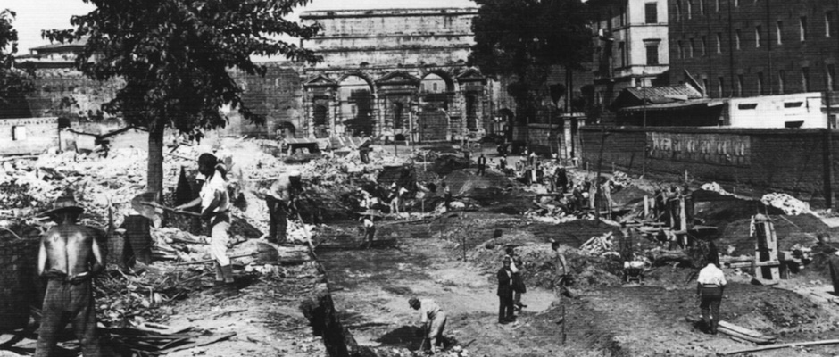
The analysis of literary and epigraphic sources allows to identify through the centuries the boundaries between public and private properties and the birth and development of the necropolis of Porta Maggiore, brought to light by the earthwork of 1871.
Numerous inscriptions preserved by the National Museum of Rome belong to this necropolis. They allow us to understand the transformations undergone by the sepulchral landscape of this ancient Roman suburb with its historical, social and economic problems, between the Late Republic and the Late Imperial Age.
Scientific coordinators: Gianfranco Adornato, Andrea Giardina
Contributors: Francesca D’Andrea